REVIEW · HOBART
30 Minute Scenic Hobart Plane Flight
Book on GetYourGuide →Operated by Par Avion Wilderness Tours · Bookable on GetYourGuide
From the ground, Hobart is beautiful.
From the air, it clicks into place. This 30-minute scenic flight over Hobart gives you a bird’s-eye view of the city, the Derwent River, and the dramatic backdrop of kunanyi / Mount Wellington.
I love how fast you get the payoff: you’re up in the sky from Cambridge Aerodrome and quickly tracing the river toward Hobart’s landmarks. I also like the way the flight is paced, with the route designed to show big geographic features in a short time—especially the Derwent River and Tasman Bridge—plus plenty of time looking down at the harbour and coastline.
One consideration: it’s only 30 minutes, so if you’re hoping to linger at one specific spot, this isn’t built for that. Also, the aircraft type can vary depending on group size, which can affect how the cabin feels.
In This Review
- Key Things That Make This Flight Special
- Entering The Sky Above Hobart From Cambridge
- Eastern Shore to the Derwent: Your First Big View
- Up-River Toward MONA and the Northern Suburbs
- Kunanyi / Mount Wellington: The 1,270 m Backdrop Shot
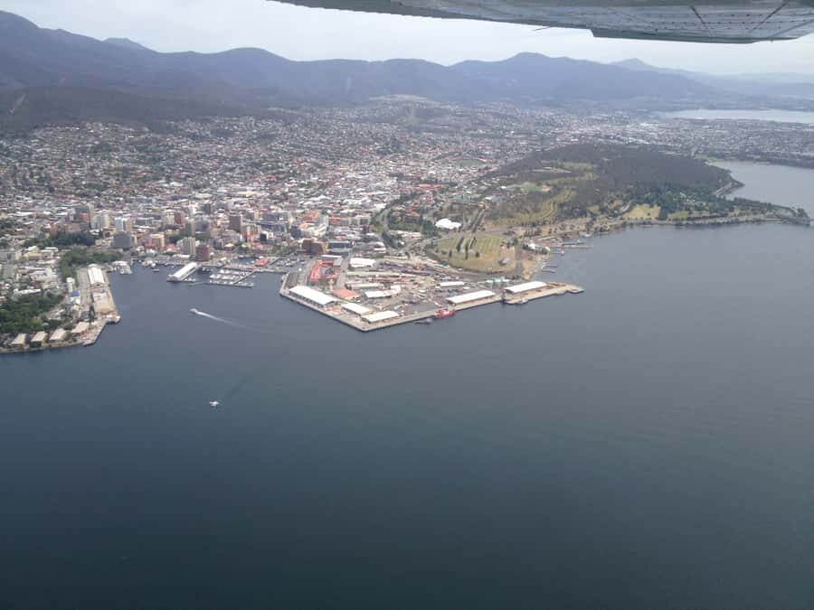
- Over Hobart City and the Harbour Area
- Kingston, South Arm, and Clifton Beach on the Return
- Price and Value: What $140 Buys in 30 Minutes
- Who This Flight Fits Best (and Who Might Skip It)
- Pilot Commentary and the Feel of the Experience
- Practical Tips for a Better Flight Day
- Should You Book This 30-Minute Hobart Scenic Flight?
- FAQ
- How long is the Hobart scenic flight?
- Where do I meet for the flight?
- When should I arrive at the airport?
- What can I see during the flight?
- Is the flight wheelchair accessible?
- Is there a way to book without paying right away?
Key Things That Make This Flight Special
- A tight 30-minute route that still covers Eastern Shore, Derwent crossings, Hobart, and return over Kingston and South Arm
- Tasman Bridge visibility as a clear river landmark during the outbound leg
- MONA and the Northern Suburbs spotted from above as the flight tracks up the Derwent
- Kunanyi / Mount Wellington (1,270 m) showcased during the fly-down toward the city
- Harbour + city views that help you understand Hobart’s shape, not just its skyline
- Clifton Beach coastline included on the way back, with a surfer-friendly shoreline view
Entering The Sky Above Hobart From Cambridge
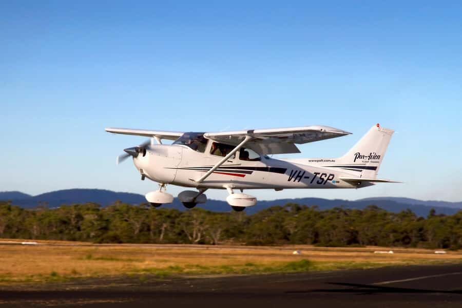
The experience starts at Cambridge Aerodrome (115 Kennedy Dr, Cambridge, Tasmania). That location matters because it keeps the flight simple: you’re not spending time commuting across town before you get your view. Aim to be there early—plan on arriving at least 30 minutes before departure—so you can settle in without stress.
Once you’re airborne, the whole region reads differently. From above, Hobart isn’t just a city by water; it’s a place shaped by river bends, steep slopes, and coastal communities. You start seeing how the city hugs the Derwent and how the harbour opens up.
If you're still narrowing it down, here are other tours in Hobart we've reviewed.


Eastern Shore to the Derwent: Your First Big View
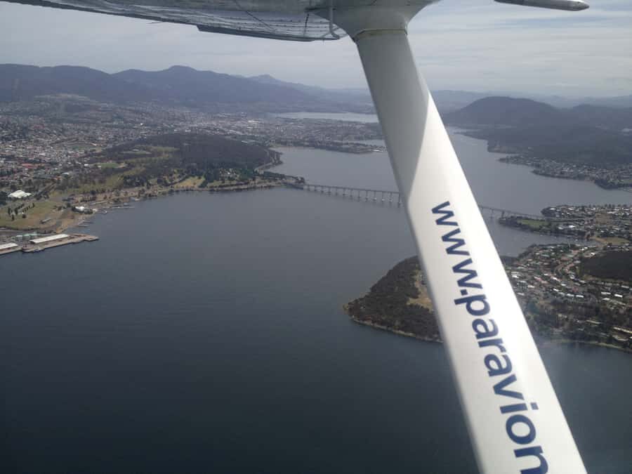
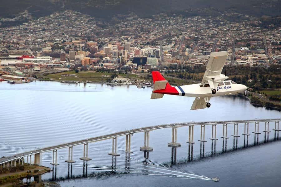
Your flight follows the Eastern Shore and then crosses the Derwent River. This section is a strong opener because it gives you a wide-angle sense of where everything sits relative to everything else—water in front, land patterns around it, and the city far enough away to take in as one piece.
Then you’ll track along the river and spot major bridges. The highlight here is Tasman Bridge, which looks surprisingly different from the air. Instead of thinking of it as just a crossing, you’ll see it as a key connector in a river corridor that also shapes city movement and skyline views.
Up-River Toward MONA and the Northern Suburbs
After you cross the Derwent, you head up river toward MONA (Museum of Old and New Art) and the Northern Suburbs. Even if you don’t plan to visit MONA on this trip, it helps to see where it sits along the water. From above, it’s easier to understand why the museum has that waterfront draw.
This up-river segment is also great for orientation. You’ll be looking down at neighbourhood patterns and the way the river curves, which makes the next part—coming back toward central Hobart—feel smoother. You’ll get the sense of a “loop” in the flight path, rather than random flying.
And yes, it’s short, but that’s the point. In 30 minutes, the goal is not to cover every centimetre; it’s to show you the main shapes so Hobart makes sense when you land.
Kunanyi / Mount Wellington: The 1,270 m Backdrop Shot
One of the most striking parts is the fly-down past Mt Wellington (kunanyi), which is listed at 1,270 m. This is the mountain you’ve probably heard about, but seeing it in relation to the city changes your mental map instantly. The mountain doesn’t just sit behind Hobart—it towers over it.
In winter, its rugged peaks are often dusted with snow. That’s not something you should bank on year-round, but if you’re flying in the colder months, it can add a dramatic contrast to the darker water and city tones below.
If you’re someone who likes “place-defining” views—one that tells you what you’re really looking at—this is the part to watch closely.
Over Hobart City and the Harbour Area
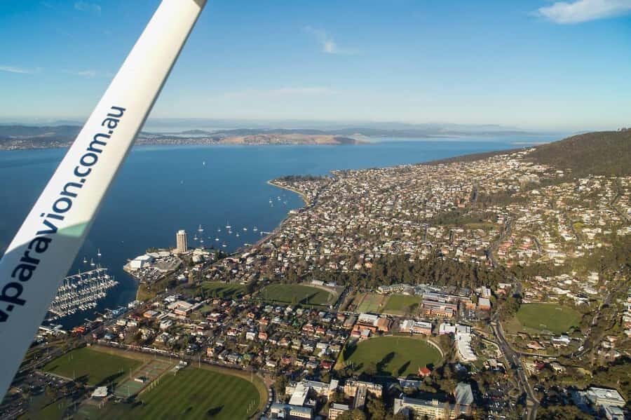
Next comes Hobart City and the harbour area. This is where the flight earns its keep for first-timers. From the air, you can connect the dots between waterfront, city blocks, and how the harbour fits into the broader Derwent system.
I also like that this part feels practical. You’ll likely come away with better bearings for how you’ll explore on the ground—where water viewpoints might be, where city centres sit relative to the harbour, and which areas look best for photos.
If you’re curious about angle, this section is built for it. You’re not only seeing buildings—you’re seeing the geometry of the coast, the harbour edges, and the way boats and shoreline meet the city.




Kingston, South Arm, and Clifton Beach on the Return
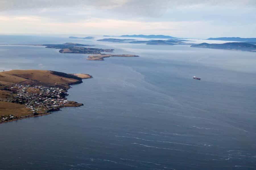
On your return, the flight passes Kingston, the South Arm coastal community, and Clifton Beach—a popular surfing location. This is a nice change of pace from the dense city view. Instead of focusing on urban structure, you get a feel for the outer communities and the coastline character.
The South Arm and Kingston sweep is especially useful if you’ve been wondering what’s beyond the waterfront. From the air, those areas look less like “day-trip possibilities” and more like a natural extension of the Hobart region—quiet coastlines, water access, and shoreline curves.
Then there’s Clifton Beach. Even without getting any extra time on the ground, you can spot its shape as a surf spot and see how it sits within the coastal stretch.
Price and Value: What $140 Buys in 30 Minutes
At $140 per person, this flight is clearly a splurge—especially if you’re used to tours that last half a day or full day. But it also holds value because you’re paying for a specific outcome: a high-impact, aerial viewpoint over multiple landmarks in only 30 minutes.
Here’s how I think about it:
- You’re not just buying “a plane ride.” You’re buying a condensed route that includes the Derwent River, Tasman Bridge, MONA, Mount Wellington, plus city and coastal views.
- The time is a feature, not a flaw. If your schedule is tight, this is an efficient way to add a signature experience without losing a whole day.
- If weather cooperates (and you’re there when you’re scheduled), you often get that rare “understood Hobart instantly” effect that’s hard to replicate from land.
If you’re traveling as a couple, this is also the kind of experience that works as a birthday or anniversary treat because it feels personal and scenic without being complicated.
Who This Flight Fits Best (and Who Might Skip It)
This is a great fit for you if:
- you want a signature Hobart view but don’t want to spend a whole day on logistics
- you’re the kind of traveler who loves photos and wants angles you can’t get from viewpoints alone
- you’re visiting for the first time and want the city’s layout explained visually
It may be less ideal if:
- you hate short experiences and wish you could linger at multiple spots
- you’re looking for a tour that includes long explanations on the ground (this is about being in the air)
One more detail that can make it feel extra personal: your pilot will do their best to fly overhead if you live in the city. That’s a small gesture, but it turns the flight from scenery into a moment you can relate to.
Pilot Commentary and the Feel of the Experience
The best flights are the ones where you’re not just looking down—you’re getting context while you look. This experience is known for having a pilot who can be competent and friendly and provide interesting commentary during the flight.
In at least one instance, the pilot named Theo was mentioned as excellent and as giving commentary while flying over Hobart and the surrounds. If you get a similar setup on your day, you’ll likely come away with more than images—you’ll come away with a clearer sense of where you were and why those spots matter.
Also, the fact that the aircraft type varies by group size means the experience can feel a bit different day to day. Still, the core route is consistent: the goal is the same—Hobart from the sky.
Practical Tips for a Better Flight Day
Bring layers. Even though the flight is short, you’ll appreciate warm clothing—especially if you’re flying in winter when kunanyi / Mount Wellington can show snow dusting. Comfortable layers also make it easier to enjoy the view without constantly adjusting your outfit.
Have your camera ready early. The most dramatic moments tend to come quickly: the moment the Derwent opens up, the sweep past Tasman Bridge, and the fly-by timing as the city and harbour area comes into view.
Try to look out with your whole head, not just your phone. From the air, Hobart’s power is in the shapes—river curves, harbour edges, and mountain-to-city scale. If you spend the flight scanning broadly, the photos you take will match what you actually saw.
Should You Book This 30-Minute Hobart Scenic Flight?
If you want a fast, high-impact Hobart experience, I’d book it. For $140 per person, you’re buying a short but well-designed aerial route that covers the big hitters: Derwent River, Tasman Bridge, MONA and the northern suburbs, Mount Wellington (1,270 m), Hobart harbour and city, and the return sweep past Kingston, South Arm, and Clifton Beach.
It’s especially worth it if your time is limited, you’re traveling for a special moment, or you want that clear “now I get this city” feeling. If you’re the type who needs hours and hours of guided storytelling, you might prefer a longer day plan—because this one is built for the sky, not the slow pace.
FAQ
How long is the Hobart scenic flight?
The flight lasts 30 minutes.
Where do I meet for the flight?
The meeting point is Cambridge Aerodrome, 115 Kennedy Dr, Cambridge TAS 7170.
When should I arrive at the airport?
Please arrive at least 30 minutes before departure.
What can I see during the flight?
You’ll fly over the Eastern Shore, cross the Derwent River with views including Tasman Bridge, head up toward MONA and the Northern Suburbs, pass Mt Wellington, then see Hobart City and the harbour, and return past Kingston, South Arm, and Clifton Beach.
Is the flight wheelchair accessible?
Yes, it is listed as wheelchair accessible.
Is there a way to book without paying right away?
Yes, it offers reserve now & pay later and also free cancellation up to 24 hours in advance for a full refund.